2025 Post-Wildfire Lidar Data for Los Angeles, CA
Following the devastating Los Angeles, California wildfires in January 2025, NV5 (a geospatial, engineering, and consulting company that serves as a prime contractor to the 3D Elevation Program via the USGS Geospatial Products and Services Contracts) acquired high-resolution airborne lidar data for the Palisades and Eaton impact areas. Through its partnership with University of California San Diego (UCSD), NV5 donated the interim data to the USGS to make them publicly available for use by the emergency response community and others.
About the Lidar Data
The Digital Elevation Models (DEMs) and Digital Surface Models (DSMs) for the Palisades and Eaton impact areas are available above.
These datasets are provided as-is for emergency response purposes and have not been reviewed by USGS for accuracy.
The DEMs and DSMs are 0.5 meter resolution. The horizontal projection is UTM Zone 11N NAD83(2011), referenced to the NAVD88 Geoid 18 (m) vertical datum. The vertical units are in meters.
The Palisades area dataset was collected on 1/21/25, and the Eaton area was collected on 1/21/25 and 1/22/25.


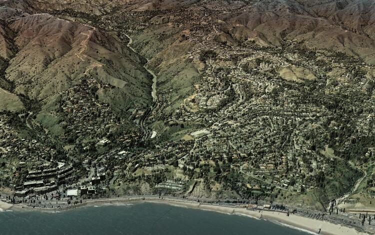
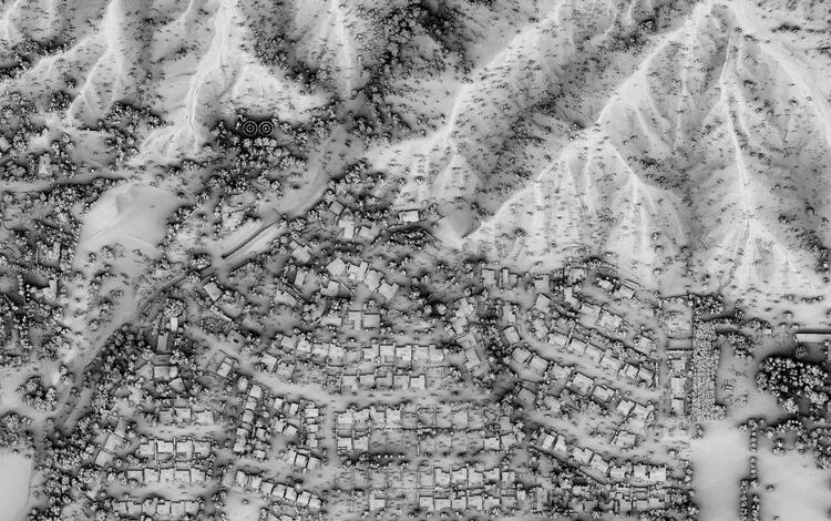
Lidar-derived images of the terrain in the Los Angeles area immediately after the Palisades and Eaton wildfires in January 2025. Image at top left courtesy of NV5. All data sources courtesy of NV5. More information about wildfires can be found on USGS’s Wildland Fire Science webpage.
Following the devastating Los Angeles, California wildfires in January 2025, NV5 (a geospatial, engineering, and consulting company that serves as a prime contractor to the 3D Elevation Program via the USGS Geospatial Products and Services Contracts) acquired high-resolution airborne lidar data for the Palisades and Eaton impact areas. Through its partnership with University of California San Diego (UCSD), NV5 donated the interim data to the USGS to make them publicly available for use by the emergency response community and others.
About the Lidar Data
The Digital Elevation Models (DEMs) and Digital Surface Models (DSMs) for the Palisades and Eaton impact areas are available above.
These datasets are provided as-is for emergency response purposes and have not been reviewed by USGS for accuracy.
The DEMs and DSMs are 0.5 meter resolution. The horizontal projection is UTM Zone 11N NAD83(2011), referenced to the NAVD88 Geoid 18 (m) vertical datum. The vertical units are in meters.
The Palisades area dataset was collected on 1/21/25, and the Eaton area was collected on 1/21/25 and 1/22/25.


Lidar-derived images of the terrain in the Los Angeles area immediately after the Palisades and Eaton wildfires in January 2025. Image at top left courtesy of NV5. All data sources courtesy of NV5. More information about wildfires can be found on USGS’s Wildland Fire Science webpage.


